Thanks so much for showing interest in hawkwatching at Mt. Watatic! 2024 will be my 10th Fall counting raptors there, and I really think it’s one of the best birding experiences in Massachusetts!

2024 Schedule: I will be up on the mountain every weather-permitting day from Sat 9/14 through Sun 9/29.
I typically count from 9-4pm, although I will start a little earlier and stay a little later on busy days. Visitors are welcome to come anytime in that window or the whole window, on any days! I know it’s a long day and a major commitment, and I am fully realistic that it’s not the most convenient place to get to. Ultimately, the more time spent on the mountain, the more hawks you can see. The majority of raptors I count require binoculars to see, although we get a great share of close, naked-eye birds over the summit too. I recommend 8x power binoculars, and generally don’t recommend pocket binoculars, although that’s surely better than nothing.
Timing and Weather:
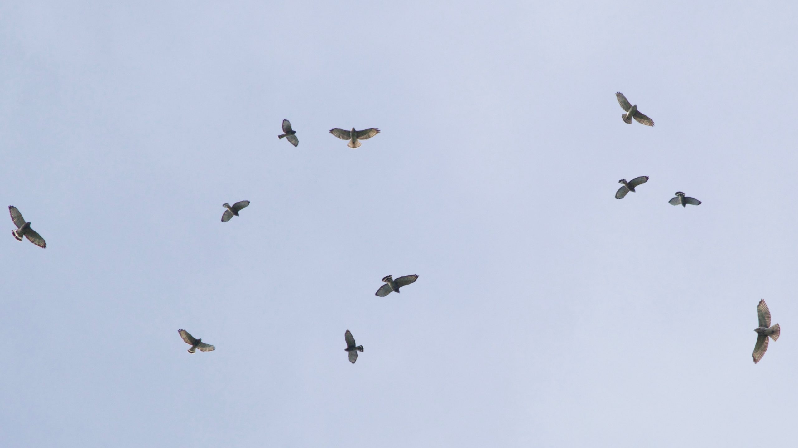
The reason for the timing of my watch is to coincide with the peak of Broad-winged Hawk migration in Massachusetts, which traditionally is 9/10-9/26 every year. My hope is to see somewhere around 5,000 Broad-wings during my “season” – sometimes more, sometimes less. Unfortunately hawks don’t read calendars, maps, or weather reports, so it is quite unpredictable on a day-to-day basis. Generally days with a North wind are best. N, NE, NW winds are all great conditions for us. W is fine, but generally S winds are a negative factor. One thing to keep in mind is that the closer we get to the peak of the Broad-wing window, the less the wind direction matters. Birds ‘need to go’ so they may be moving South against surprising wind conditions! Usually we’ll be able to predict conditions for a good day on the day before, but rarely sooner than that. Raptors do not migrate in heavy precipitation and I do not count in the rain. If it’s a light shower, I may try to stick it out, but I will generally come back down the mountain in wet conditions. Other acts of nature to be aware of up there are fog and insects, but generally these are only temporary problems!
In my experience, the weather is almost always perfect up there this time of year… usually a few degrees cooler and a bit windier than the surface forecast. The early hikes in September can be in the 40s-50s on occasion. I will add there is very limited shade on the summit, so sun protection is also something to consider.
The Hike:
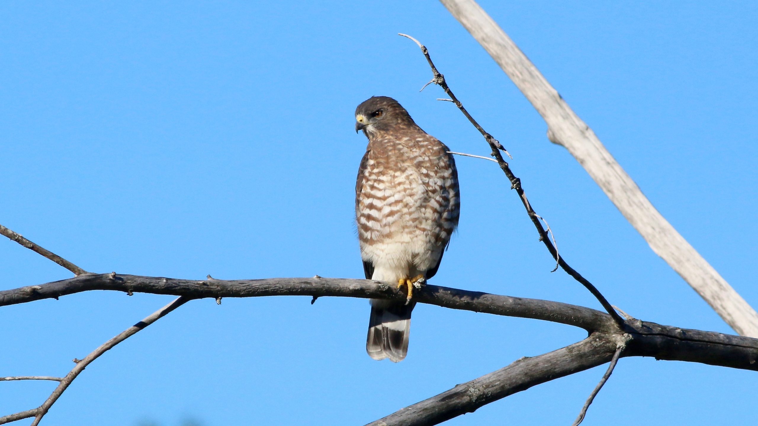
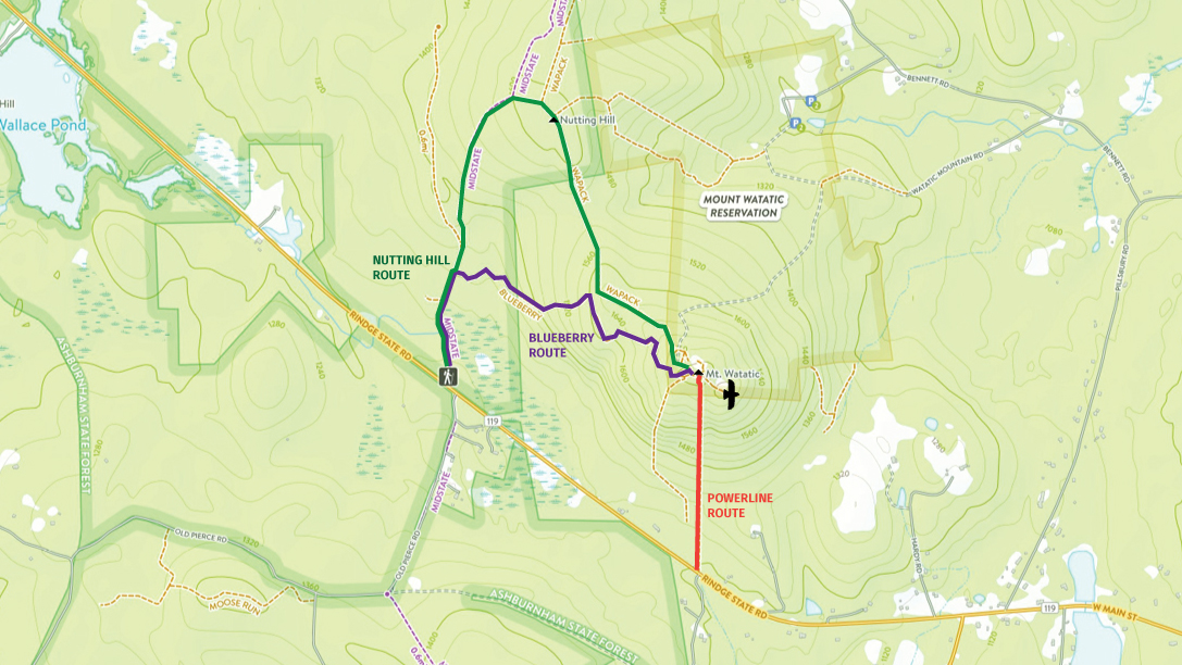
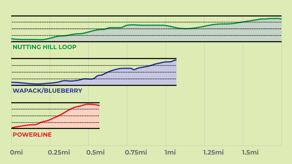
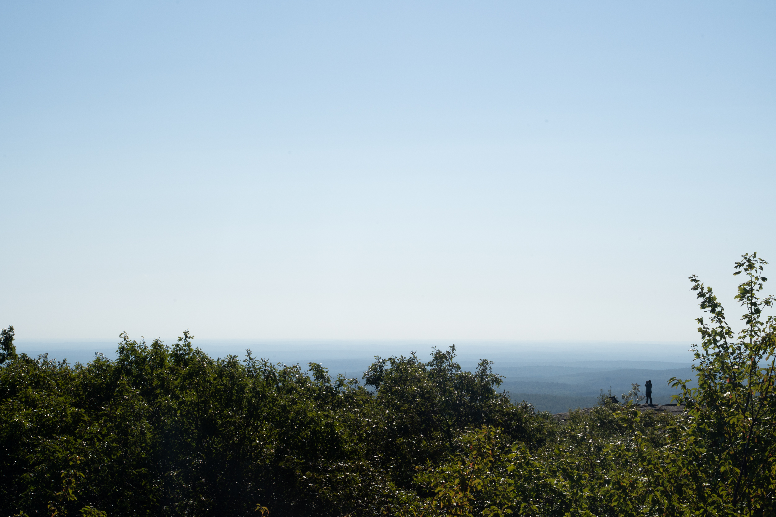
The Eastern Mass Hawk Watch site has general directions and trail details that you may want to review beforehand: https://massbird.org/emhw/where-to-go-hawk-watching/. The Wapack Trail up to the Watatic Summit is the most popular route – most folks at Watatic are going to the top so it’s not too hard to follow the crowd. Different maps may call this the Blueberry trail. The trail is a moderate 1.1 miles with 650 feet of elevation gain, which takes me 35-45 minutes, and is marked with yellow blazes. It is steep in some sections but not technical. There are a few signs and blazes are pretty consistent, but generally going with the flow of hiker traffic will take you to the top. At the top of the mountain, there is a ‘true summit’ which is higher and has an OK view, but I count raptors from the ‘East summit’ which is nearby and just slightly lower – it has a much better 270° view. There is a short ‘saddle’ trail that connects the summits. If you look East from the true summit, you should be able to make out the rocky East summit – there’s almost always someone over there.
There are two other routes to the summit – the longer, less-steep Nutting Hill Route and the shorter, steeper Powerline Route. Again, I recommend the Wapack Trail/Blueberry Route, as I believe it is a good balance of length and steepness.
Trail Summary:
- Wapack Trail/Blueberry Trail/Blueberry Ledge Trail
- 1.1 miles, 35-45 minutes
- Moderate, some steep sections (max grade 28%)
- Nutting Hill Loop/Wapack Trail + Mid-State Trail
- 1.6 miles, 45-60 minutes
- Moderate, more gradual, traverses Nutting Hill (max grade 20%)
- “Powerline” Trail
- 0.5 miles, 25-35 minutes
- Strenuous, steep throughout
- All routes approximately ~650 feet elevation gain
- No water / No restrooms / No on-site staff
Driving Directions:
If you drive to Mt. Watatic, note that there is a very small lot at the Google Maps pin for “Watatic Southern Terminus” on Rt 119 in Ashburnham. The signs read “Mount Watatic Parking.” This lot will be full before 8am on weekends, and is where the Wapack Trail starts. Overflow parking is on the right side of Old Pierce Road, across from the lot.
Just for background info, there’s also a smaller unsigned lot on Rt. 119, that Google Maps has called “Mt. Watatic Summit Trailhead” but this is an alternate trailhead for the “Powerline” trail. It is shorter, but much steeper and more strenuous. I have taken it once to see what it’s all about but I do not recommend it, but for a vigorous hike experience in a straight line up. I see some people park at this unsigned lot, then walk a mile down Rt 119 to the signed Wapack Trail parking lot to start their hike… this I would not recommend either, I think these are just confused first-time visitors. I’m just mentioning this, since if you approach Watatic from the South, you may see cars parked at the unsigned lot first and don’t want you to get confused.
Supplies:
Here’s my thoughts on supplies to be the most comfortable for hawkwatching up there, in order of importance! Unfortunately there are no restrooms, trash facilities, or water available. It can be both scorching and frigid on the summit, so I always try to keep gloves and sunscreen both handy!
- Water
- Binoculars
- Sun Protection
- Layered Clothing
- Food/Snacks
- Toilet Paper
- Something to sit on (backpacking chair, foam pad, etc.)
I have a more complete story on Mt. Watatic migration in the form of a slideshow here: http://brianrusnica.com/wp/resources/. Feel free to check that out if you have more questions!
Here’s my # if you have any questions! 617-680-8475. Feel free to text or message me any questions that you might have!